Monday, August 11, 2014

Rotherfield Revisited


Just the 3 intrepid hikers set out to complete a 7.5 mile circuit to the north and east of Rotherfield. All members had previously undertaken some working duties in or around the area, which is bordered by woods formerly part of the Ashdown forest. We were looking forward to a mainly woodland walk that would provide shelter from the sun on what turned out to be another extremely warm and sunny morning.
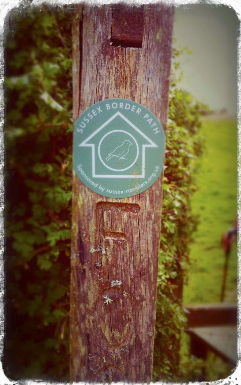
With one eye to the weather we set off early, parking up and commencing our walk from North Street on the edge of the village. Within 10 minutes we turned right onto a Byway that was to be a main feature of our days toils.


After about a mile we headed north onto a footpath that took us down into the valley floor and over the first of several footbridges. We were heading for the dismantled railway line that ran through to Heathfield back in the day as part of the Cuckoo line.

Rotherfield Station
We reached the site of the old station, which was opened in September 1890 after several attempts to raise the capital required had failed. The buildings have long since disappeared as the station was closed in 1968 and has been replaced by a stud farm.


We followed the track north for a further mile and a half before reaching our first woodland, Entryhill woods. We had already been climbing steeply from the railway cutting and continued to climb much to one members distain through the woodland path and back onto the Byway.


A further steady climb half a mile brought us to the brow of the hill where we picked up a road bordered to our north by Saxonbury hill, the site of a former fort. Stopping to take on water we were briefly  joined by an inquisitive foal in the adjacent field. Refreshed, we headed along the road for a good mile resplendent in Hi-Vis vest until we reached Great Danegate, a former large farm and oast that had been taken over by a firm of publishers.


There were plenty of cob nuts on display throughout our hike but none were ‘ready for the picking’.
After well over an hour of mostly hill climbs we reached the summit as we turned south back onto the Byway and headed steeply downhill on a track that had been shaped by the torrents of water that had cascaded down the track in previous months.

We continued to descend until we reached the valley floor which contained a stream, which now almost disappeared, showed the nearby signs of its previous power. A further footbridge had been added to ensure safe passage and we made this our base for our refueling stop.

Refreshed and at the valley floor, we expected, and were not disappointed, by the steep climb through Card’s wood and then Hoth wood to once more cross underneath the dismantled railway, via a small bridge.

 We entered Little Millhole wood to find another elaborate two staged footbridge to safely take us across a small water course, before crossing the road and having to backtrack a couple of hundred yards to find our entrance point into Hornhurst wood.

We continued to climb and with the absence of signage emerged from the woods by Sweet Meadow farm before walking back to the start point. An arduous 3 hour walk which seemed mostly to contain lengthy uphill segments punctuated by short steep downhill segments, a very challenging but enjoyable morning well spent in great company!

Thursday, July 31, 2014

Exceat Exercise Expedition

There had been a break from the usual weekly routine of hiking across the local terrain, so the group of 5 were keen to tread some miles and lever the boots on outside the Cuckmere Inn which overlooks the Seven Sisters Country Park.
The forecast meant that there was little reason to carry waterproofs and only headed out with a
variety of light snacks and plenty of water.
The route took us from the car park onto the footpath south toward the coast, but no sooner getting into our stride we turned west and followed the footpath onto Chyngton Lane.

The hedgerows were showing signs of an abundance of unripened blackberries. We watched also as a herd of cattle were politely queuing to drink from a gurgling water trough. They clearly had seen the forecast as we had and thought wisely about the amount of water required to survive the day.

We arrived at the junction of the lane and the main coastal link road between Seaford and Eastbourne. Traffic was frequent but we soon managed to find safe passage to the other side.

We entered a continuation of the same lane on the opposite side until we turned onto a narrow grass track, which would lead us to meet the Alfriston Road. Toward the end of this footpath we came across a bottle of water and a dog bowl. Clearly it was a dog friendly gesture to ensure the dogs were being hydrated by a kindly local resident.
The track, after crossing the Alfriston Road, started to climb gradually. A flock in excess of 200 sheep filled the field to our right. Their conversation was only occasionally translated into intelligible expletives although they were all enjoying the sunshine and views as much as we were.

We reached the elevated point on Frog Firle and were soon walking alongside a hedgerow of sloes which were also showing signs of potential ripening. Nobody was brave enough to sample it however reflected on the merits of previously making Sloe Gin in a past life.

We were now walking amongst the sheep referred to previously and they seemed willing to allow us free passage through whilst watching various off-spring still determined to sucker nourishment from their mothers.
We reached the end of the field having viewed the valley below to our left.

The Rathfinny Estate has been establishing one of the finest vineyards in the country in this area. Read more.

We started a steady descent towards the river below, under the gaze of the white horse. As we crossed the bridge we stopped and rested for a short snack and to ensure our hydration levels were at an optimum level.

The river path was our route back toward the car park. There were 4 women on the opposite bank that gave rise to our concerns. They were static, staring across toward the edge of the wood beyond us. Not certain what it was about exactly, but were glad to get pass them without any curse or spell put on us.... well no evidence of it thus far.

We saw a 'herd' of fish swimming back and forth as black headed gulls swooped down to consider a catch of the day. A little further and a 'challenge' of canadian geese stood firm on the opposite bank. A couple of dogs were mildly tempted to make a chase of it, but were under strict command of their owner not to... (we assumed).

There was little more to do but cross the busy coastal road again having given directions to some young lost looking tourist types who were in search of the seven sisters. We sent them in the opposite direction. (no, we didn't really!)
We released our boots having completed the 5.5 miles circuit and not feeling too exhausted despite the sun beating down on the cars that were giving an excessively high temperature reading of almost 30 deg C... til the next time.

Saturday, July 19, 2014

The Heat is On (Glenn Frey - 1984)

The weather forecast spoke of it being the hottest day this year with threats of storms later, but that wasn't going to stop the 5 strong pose gathering under the gaze of the Long Man in Wilmington.
With due consideration to the fluids to carry and which direction to undertake the circuitous venture we strolled toward the church's graveyard and paid our respects to the majestic Yew tree, chained and supported in position.

The fields were turning more golden and made an easy paced stride down the first few fields toward Milton Street and onwards towards the river Cuckmere.
The breeze was keeping a cooling pressure on our face as we walked alongside the river. Cattle grazed on the opposite bank and watched us with some curiosity. The temperature was rising to the high 20s at this point and before we turned into the small village of Littlington we stopped on a bench which was conveniently in the shade and took on much needed fluids. After a brief exchange with a dog walker who was checking for cattle occupancy we saddled up and moved onto the road for a short time and then followed the road toward Clapham  Farm. Running up the lane appeared to be an option for a couple of us, but soon ceased when the shade of trees became a more attractive idea.
At the top of the hill the activity of agricultural machinery filled the air. The rampant tossing of hay or straw was maintaining the attention of the driver as we crossed his path with little awareness of our presence it seemed.


We continued to soak in the blue-skied landscaped which surrounded the top of the hill. The bleating sheep echoed from a nearby field. Another small hill, then we dropped into a short wooded area that gave much appreciated shade.


The heat was causing some serious melt-down conditions in several of us and another liquid re-fuel was required before walking up the next half mile incline. On several occasions we had come across a flurry (or plague?) of blue butterflies (common blue?) that were attracted to piles of fresh horse poo! Once at the top, it was a chance to take a rewarding break and look out across Lullington Heath National Nature Reserve. Meanwhile the peaceful surroundings were almost deafening as the gentle breeze kept us all ventilated (to a degree).

A final stretch and we were navigating our way across toward Windover Hill. We stopped and admired more landscaped vistas across toward Firle Beacon.

A half later we were overlooking the Long Man of Wilmington and checking on water levels in Arlington Reservoir and viewed upon the unique patchwork of fields that lay beneath us.


As we descended the hill we noted the recently reported 'corn circle' that had appeared overnight a few weeks ago. It was but a simple pattern that could have been quickly overlooked as a practice circular attempt which didn't warrant further expansion. Either that, or the designers were caught amidst their valiant treading of corn stalks.
We had concluded our walk registering 7.6 miles on the pedometer in around 3 hours. Rehydration was the order of the day in the hope of cooler walks to come.

Thursday, July 3, 2014

Aromatherapy & Alpacas

The Hikers were out in force, as the 5 strong team of booted personnel congregated in the car park of the Merrie Harriers, Cowbeech with the July sunshine already raising the temperature to around 19°C. We'd stated that we should approach this venture as a 'stroll' and not a challenging route march as the heat was destined to rise to the mid 20's.
The lane opposite the pub invited our steps for the first mile, that soon turned into faithful footpaths. The lanes were only occupied with the occasional Range Rovers today and a healthy wave of acknowledgement as we stood aside was offered in gratitude rather than recognition.
A horse and its rider trotted passed us, commenting upon the rarity of seeing 5 men out hiking along the local lanes.... we assured her that it happens very rarely.

We then came across the site of some Alpacas in a farm yard area. Dr Doolittle of our group tempted them for some affectionate stroking (so he informed us) however we were more concerned that one in particular was setting up his aiming technique for some saliva driven target practice. We quickly turned and got back into our stride.

Down a short track and we were soon in the sheltered area of a small wooded area before entering into the large orchard full of fruit laden trees of Greenway Fuit Farm. Firstly pears, then apples and some plums. Rows of cherry trees were captured in nets to stop tempting birds to devour the produce. But not only the sight but the smell of fresh fruit permeated the fields as we walked, and the large pylons towered over the entire area.


We arrived on the lane and walked a short distance to another field where normally horses are grazing. However today, there were no livestock and the following field only had a collection of large circular black plastic bundles of hay, grazing quietly. To the north the views of the Weald were illuminated by cloudless blue sky and bright sunshine.

We crossed over the main Cowbeech road and entered more fields. This time crops of sweetcorn were in partial growth with no sign of cob development yet. We again entered another small wooded area (Little Gensing Wood) which we surmised was being used to cultivate chestnut trees for using as stakes. We found a small area of cut logs where we then sat and took on fluids and a small snack.

We crossed another field before walking down the long drive of Blackford Farm. Through the heart of the farm and out the other side along a concrete drive, we turned right and came out to cross our last challenge, whilst looking at what appeared to be 2 large soaring birds of prey, the name of which escaped us all even though we had several good guesses. The challenge that lay ahead of us was not just a field of new growth of grass, but in it was a tractor, spreading fountains of liquid manure. Thankfully he had gone to the top end of the field, however we had to encounter the area of field over which he had just spread the contents of the trailer. The aroma was noticeable and was in complete contrast to the more pleasant and distinct fragrance of the fruit farm. In fear of both our lives and the tractor returning, we hastily walked to the gate through which we could escape the perils of further muck spreading.

Our final half mile back to the pub was a simple trek along the road which connected Cowbeech to Vines Cross (Hammer Lane). We arrived at the car to discover (just by chance) that the pub was open for business. It seemed only right to take a beverage there, as they'd be kind enough to provide their car park to us. Re-hydration was accomplished within half hour unlike our 2 hour, 4.5 mile stroll.
I'll drink to that!

Sunday, June 29, 2014

Fields of Gold

‘You’ll remember me, when the west wind moves, upon the fields of barley’ -  Sting (1993)

Thursday 26th June 2014, the three hikers set off from Upper Dicker to trace a route provided by Wealden walks entitled water water everywhere. However, not being inclined to adhere to convention our intrepid three made many of their own tracks in completing this circuitous route.


With the sun on our backs and just the threat of an occasional shower (Carol had said we would be unlucky to find one) we set off in the opposite direction to that advised by Wealden walks, from Bedes school at 09.30hrs. Bedes school used to be known at St Bedes, however, to have a greater international appeal to people of all faiths it lost its saint and became just Bedes. Walking past the day scholars resplendent in their green and black uniforms we made our way West along the public footpath past Clifton Farm and soon found ourselves at the most northerly point of our walk at Marnhull Farm to pick up the Vanguard Way heading towards Chalvington.


En route we discussed the decline of English football and listened intently as the salty sea dog of the group recounted tales of his latest sea expedition and fortunately for us he omitted all of the cornish sea shanties although later took to demonstrate some sharp moves on the dance floor and his methods for attracting people of both sexes to be his dancing partner!

We made our way south westward for a couple of miles along a seldom used ‘c’ road whereupon we arrived at bungalow farm where a small industrial unit was renovating classic and prestige motors.


We continued on the Vanguard way towards Berwick, passing by a small mansion house that we remarked was quite a few bricks short of Mountfield Court that we had visited in recent weeks, however, set in its own grounds and overlooking the Cuckmere valley  one could be forgiven for expecting to see the farm hand and the scullery maid cavorting in the corn fields after their duties were fulfilled for the day!


We had yet to see any water until a badly sited marker led us through the back garden of a comely house and grounds ensuring we maintained both our footing and a respectful distance from both


house and ornamental pond. After exiting the garden it became clearer as to the path we should have trodden and would of course have seen the appropriate marker had we not been completing our circuit ‘the wrong way round!’ Continuing on the Vanguard way we arrived at Arlington Reservoir and stopped for brief refreshment, a quick lesson in fly fishing and listening in to others very loud conversation. The reservoir of 120 acres was created in 1970 and supplies 5 million gallons of water each day to the Eastbourne area, it is fed by the Cuckmere river and has become a wildlife sanctuary with over 170 species of birds calling it home and 10,000 additional seasonal feathered visitors.


With spirits lifted we headed off around the perimeter of the reservoir  for about a mile before departing in search of the Weald Way that would take us back towards Upper Dicker and our journey’s end, however due to an incompatibility glitch between the 1874 map we were using and the siting of the Weald Way we ended up creating our own new routes taking in both fields, tracks and very busy main roads back towards our vehicle. (ed. hi-vis vest?)


When in site of the local pub the Plough we found the officially re-sited route of the Weald way and to celebrate both this discovery and the end of our thirsty walk we felt obliged to calm our nerves by taking refreshing alms from the array of fine beers on offer and quenched our thirst before the final 1/2 mile back to the start/end point. 8 miles completed, some new pathways cut and the promise of a lie down in the back garden with a good book to further aid the digestion.


Friday, June 13, 2014

Bewl Water - (Revisited)

It was March 2012 when some of us ventured to walk from Ticehurst and go around part of the Bewl Water... at that time it was looking like an arid tundra in which there's normally some 31,300 million litres of water stored for use by the local water authorities. However it had been a particularly dry spring and the threat of hosepipe bans came true later in the year.
March 2012

June 2014
But this was 2 years on and nearing the mid-year summer solstice and thought it was time to revisit our tracks and see what condition the lake was in.
With due respect of the threatening heat of the day, we made an early start and were in Ticehurst by 8.30am ready to stride our way through gathering school children waiting for their transport and cut into a footpath between a house and a shop which model railway enthusiasts would have found difficult to pass without going in.... but it was closed and did little more than window shop the dusty display that was afforded onlookers.

We needed to thrash our way through the first section of the path which was looking neglected after which we dropped down into a small wooded copse then up towards Tinkers Lane. The footpath continued opposite, however the instructions guided us along the lane where locals exchanged morning greetings with us, whilst drivers had more intent on getting to work and we had to take cover in a couple of strategically positioned driveways. One of which was Washington Villas.

We were soon off the lane and walking down a concreted driveway towards a farm. Again, dog walkers appeared to be pleased to exchange greeting, whilst their dog cleverly barked at us whilst carrying a stick in his mouth. Canine talent was clearly in evidence around these parts.

A few corners more and having turned onto the 'Round Bewl Water walk' the site of the large watery reservoir confirmed our expectations in that having experienced one of the wettest springs in many many years, the levels were adequately high enough to assure locals that perhaps there wouldn't be a hosepipe ban.
We saw a lone fisherman taking mid morning opportunity to conduct his fly fishing technique as we walked pass and more dog walkers came in the opposite direction to ensure our approach was a peaceful friendly trespass.

Although the sun was hot after an hour or so of walking, we took opportunity of some clouded respite and sat a while to observe the length of the reservoir and in doing so, disturb a flock of Canadian geese. They looked unperturbed by our presence and after 10 minutes we continued around the track recalling the route we had taken previously.
We crossed Rosemary Lane and left the water behind us and navigated our way along a dedicated pathway, firstly through open land, which then led into Ketley Wood. We made a steady ascent through the shaded glade and eventually came out at the other side, arriving on the main road. We crossed it and found the footpath to Quidley which was directly opposite.

The sun was out again as we took chance to view the Weald which provided an ideal backdrop to a very well maintained Dale Hill golf course. We obligingly followed the markers across the fairways as we had before, but not before one of the group managed to strike a perfect 7 iron shot he just happened to be carrying... (not).

It was time to drop down through a very neglected looking wood in which we saw deer prints and spent cartridges where no doubt the seasonal quarry had been tracked.
We were heading for the final 'high risk' section of the walk along 500yds of Pashley Road. To reduce risk of incident, a high vis vest was donned to ward off any potential events which wasn't written in our instructions. It seemed to work, as during the brief yet intrepid walk toward the next stile, we didn't encounter any threat of car, lorry, white van or bus. What could be described as a result in some respects and will consider using it again the next time we have to walk along roads with no grass verge.

We clambered over a few more stiles, exchanged some worried looks with sheep then through a wooded section and were soon heading along the final path and into the centre of Ticehurst where we rested in the central shelter to watch the locals purchase their early lunch from a mobile Fish & Chip van.
The walk had everything you might have expected in 3 hours... 7 miles of waterside, wood, fields, golf course,  paths of varying terrain and some amazing views... surprising what you can do when you put your mind to it!!

Friday, June 6, 2014

Sherlock Stalker found in Brewery?

The day started in bright sunshine as the intrepid explorers met in Birling Gap car park. The breeze was slight whilst we took a brief view out to the sea in the knowledge that on the other side of the channel the war veterans were celebrating the 70th year when the D Day landings on the Normandy coast line. We looked down to see a group of 30 or more German students examining the shoreline.
The warmth of the sun on our backs was felt as we walked steadily west along the South Downs Way and entered the main footpath which led along the top of the Seven Sisters cliff formation.


We entered through a gate marked "Malcolm's Gate" with some musical notations, the origins of which we perhaps needed to explore further.
The 5 of us were accompanied by Oscar and Floyd, the infamous dogs from last week's walk. They were keen to explore at their own more speedier pace, whilst the remainder of the groupd felt the need to pace ourselves in the increasing heat.
We reached the seat after achieving 3 sisters and had a brief rest before heading inland toward Crowlink. We entered a field of sheep with their growing young lambs. The dogs went off to negotiate access to drink from the galvanized watering trough. The surrounding sheep obliging moved aside as Oscar felt compelled to jump in for a dip.
He surfaced, looking liberated and refreshed, as we moved quickly to avoid his shaking excess water onto us.

We continued through the remainder of the field and looked down on the small group of houses at Crowlink. A small hamlet with a single track road that leads down from the car park through which we were about to enter across the cattle grid. A couple of late starting walkers were just about to leave their car and set off in the car park and we navigated our way down the lane toward the church.

The dogs needed to be on a lead at this point and we respectfully walked through the graves and then onto the adjacent meadow which had been left uncut with a carpet of buttercups leading down the hill.
The pace was unforgivingly slowing, even though gravity was having an effect at this point. We were setting our timing to rendezvous at around 11.30 at the local Beachy Head Brewery, so a chance opportunity to sit on the East Dean Village green to have a short snack was timely to say the least.
We observed a group of some 20 or so hikers standing menacingly between the 'Hikers Rest' and the Tiger Inn. Had they been banned from entering because of some dispute over the change received after purchasing a cup of earl grey tea and a flapjack or were they just protesting about the potential threat of fracking under the sub-structure of this ancient village? We weren't to find out.
 However what we did find out about was that another smaller group with an expensive looking camera on a tripod were filming on the bench we had hoped to sit on. They were engrossed in the process of taking several random shots and interviewing several people whilst we set up on the green nearby and continued to munch away at our snacks. We later discovered a short piece had been shown on both the local BBC lunchtime and teatime news and referred to a writer who had written a novel featuring Sherlock Holmes who had, according to a blue plaque on a nearby house, retired to the village and was a beekeeper. It was interesting to see that we featured in some of the shots, lazing on the grass in the piece, added a little more interest to the day.

But our day wasn't over yet. The visit to the brewery was awaiting, and we took to the path towards the sheep centre behind which stood a less than impressive barn which contained a small micro-brewery business set up a few years ago and now producing some award winning real ale brews for the local pubs.

The hospitality was warm and welcoming and a few sample glasses of the Lighthouse brew was offered as we unstrapped our back-packs, whilst a brief explanation of the brewing process was provided by the Master Brewer. The day was warming up nicely and the quenching qualities of the beer enabled the remaining half hour walk back to the car park all the more bearable as we encountered the wrath of cars, buses and motorcycles on our roadside amble. The cattle in the field were looking protectively at us and were not going to engage in negotiating the the dogs to have access to their water trough as much as the sheep were earlier. We felt compelled to continue walking.
It was all but a 4.5 miles walk this week, but perhaps it was as much as was needed on a warm summer blue sky day.